


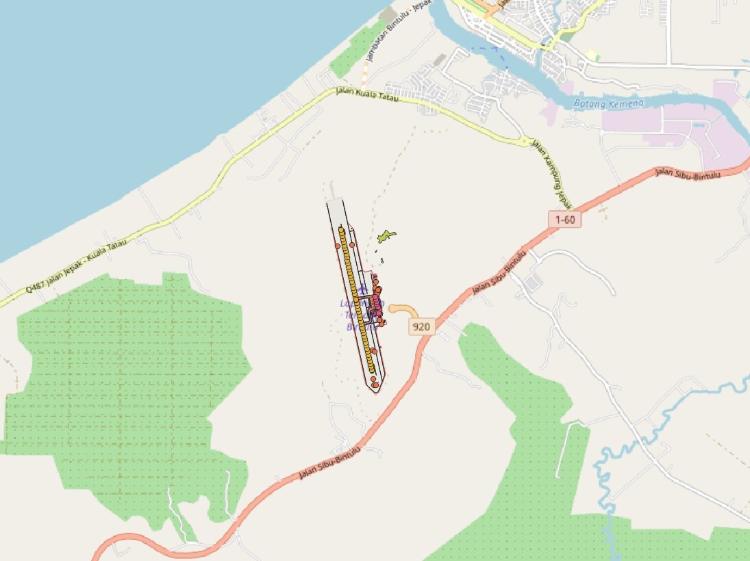
WBGB Aerodrome Surface Routing Network
Nodes and edges of the Associated Aerodrome Surface Routing Network. This represents a subset of an aerodrome that is suitable for taxiing special-seized aircraft.
Product is added into your Cart.
Nodes and edges of the Associated Aerodrome Surface Routing Network. This represents a subset of an aerodrome that is suitable for taxiing special-seized aircraft.
CAAM's AIM Portal and ETOD Data: Elevating Malaysian Aviation with Precision and Safety
Nodes and edges of the Associated Aerodrome Surface Routing Network. This represents a subset of an aerodrome that is suitable for taxiing special-seized aircraft.
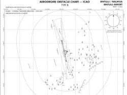
Obstacles within the take-off area of an aerodrome up to 10 km from the end of the runway.
The obstacles within the Annex-14 Obstacle Limitation Surfaces (OLS)
Aeronautical Information Services Unit, Civil Aviation Authority of Malaysia, Persiaran Korporat KLIA, 64000, KLIA, Sepang, Selangor.
+603 8871 4000 ais@caam.gov.my
