Product is added into your Cart.

x

WMKL Annex 14 Obstacle

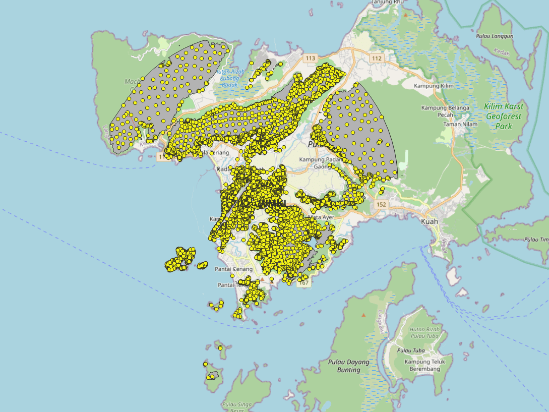
The obstacles within the Annex-14 Obstacle Limitation Surfaces (OLS)

Available Format: 

SHP, KML/KMZ, XML, DGN, DWG

Data provided by:
×
Imagery
Cesium ion
Bing Maps Aerial
Bing Maps Aerial with Labels
Bing Maps Roads
Sentinel-2
Blue Marble
Earth at night
Natural Earth II
Other
ArcGIS World Imagery
ArcGIS World Hillshade
Esri World Ocean
Open­Street­Map
Stadia x Stamen Watercolor
Stadia x Stamen Toner
Stadia Alidade Smooth
Stadia Alidade Smooth Dark
Terrain
Cesium ion
WGS84 Ellipsoid
Cesium World Terrain
Pan view
Left click + drag
Zoom view
Right click + drag, or
Mouse wheel scroll
Rotate view
Middle click + drag, or
CTRL + Left/Right click + drag
Pan view
One finger drag
Zoom view
Two finger pinch
Tilt view
Two finger drag, same direction
Rotate view
Two finger drag, opposite direction
Mar 29 202517:40:06 UTC1xToday (real-time)Play ReversePlay ForwardPause
Mar 29 2025 12:00:00 UTCMar 29 2025 18:00:00 UTCMar 30 2025 00:00:00 UTCMar 30 2025 06:00:00 UTCMar 30 2025 12:00:00 UTCMar 30 2025 18:00:00 UTC
Mar 30 2025 18:00:00 UTC

Last Updated Date: 19-Oct-2023

Effective Date: 23-APR-2024

$ 0

Related Products

CAAM's AIM Portal and ETOD Data: Elevating Malaysian Aviation with Precision and Safety

WBGB Orthophoto

Colour (RGB) stereo imagery that covers the entire obstacles surfaces, for each runway at each aerodrome. 11-bit or 16-bit imagery with X, Y and Z for each raster point.

WBGB Digital Terrain Model

Matrix of points that determine the correlated elevation of the ground around the Aerodrome. Represents bare earth surface.

WBGB Airport Mapping Database

Nodes and edges of the Associated Aerodrome Surface Routing Network. This represents a subset of an aerodrome that is suitable for taxiing special-seized aircraft.